|
|
General Information
| |
General
Information |
|
| |
Fengshan City's landform is like a fish jumping over the dragon
gate. Fengshan City is about 3.75 kilometers from west to east, and
about 8.5 kilometers from north to south. The area from north to south
is narrower and longer than the area from east to west. Mt. Feng-Tan's
height is about 71.4 meters; it is the highest position in Fengshan.
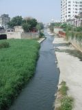
There is a river called Fengshan River, running through from northeast
to southwest. |
 |
| |
Fengshan City is located on the south of the Tropic of Cancer
area. The weather in Fengshan belongs to tropical monsoon climate.
Southwest wind blows in summer, and the northeast wind in winter.
The average temperature of the year is about twenty-five degrees,
and the average rainfall of the year is two thousand and five hundred
millimeters. It often rains in summer and fall. Every year, many typhoons
come during the period from July to September. Typhoons usually bring
a large amount of rain causing serious disasters. |
 |
| |
Fengshan lies west to Kaohsiung and has a convenient traffic
network. There are three main highways from north to south. The railroad
which connected Kaohsiung to Pingtung goes through Fengshan .The Chungshan
highway is at the west side of Fengshan. |
| |
|
|
| |
|
| |
|